Katsuragi, Wakayama Prefecture
Katsuragi, Wakayama: Persimmon Skewers and the Road to Kōya
Niutsuhime Shrine's vermilion gate, numbered stones on the Kōyasan pilgrim path, hermitages at Amano and persimmons drying under the eaves of Shigō.
Published 25 sources
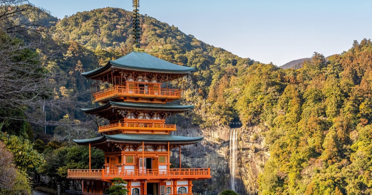
Katsuragi (かつらぎ町) writes its name in hiragana, one of Japan's three scripts, but the name itself comes off a mountain: Mount Katsuragi (葛城山), on the boundary with Osaka Prefecture. The town sits between ranges, the Izumi Mountains to the north and the Kii Mountains to the south. Look north from the valley floor on your first morning and the mountain that named the place is already in view.
What you are likely to remember, though, hangs from the houses. In the mountain settlements grouped under one name, Shigō (四郷) — Hiroguchi, Taki, Higashitani and Taira, four villages counted as a single place — persimmons are peeled, threaded onto thin bamboo skewers and hung in rows under the eaves and along long sheds called kakiya (柿屋), the drying places. Families have done this for 400 years, and the fruit on the frames is what late autumn looks like here.
Through the Vermilion Gate at Amano
Amano (天野) lies in the foothills of Mount Kōya (高野山), and the Shinto shrine at its centre, Niutsuhime Shrine (丹生都比売神社), is entered through a two-storey gate: vermilion, hip-and-gable roofed, shingled in cypress bark. Cultural Heritage Online, the register kept by the Agency for Cultural Affairs, records that it was built in 1499, and the shrine places the work in the Muromachi period. The gate is a nationally designated Important Cultural Property and part of a World Heritage site.
Past it stands a row of sanctuaries, each one bay wide in the Kasuga style, each under cypress bark. The same register dates the first of them to 1469, and the shrine explains that the buildings now standing were raised in the Muromachi period and are likewise Important Cultural Properties on the World Heritage list. From in front of the gate, count the roofs as they line up one behind another.
In front of all this is the Mirror Pond, crossed by a short arched bridge. A bridge is said to have stood at this spot since the Kamakura period, and tradition at the shrine holds that the present one was given by Yodo-dono, the wife of Toyotomi Hideyoshi (豊臣秀吉). Face it square on and the curve closes with its own reflection in the water.
The shrine's own explanation says why pilgrims came this way at all. Kongōbuji (金剛峯寺) on Mount Kōya, Niutsuhime Shrine, Niukanshōfu Shrine (丹生官省符神社) and Jison-in (慈尊院) are linked by the old main approach, the Kōyasan Chōishimichi (高野山町石道), and this shrine lies midway between Kongōbuji and Jison-in. Torii gateways, the arches that mark a Shinto precinct, stand at its entrance, and custom was to worship here before climbing. Until the Meiji separation of Shinto and Buddhism, priests and Buddhist monks kept the place together, and a monk, the shrine notes, is still sometimes seen beneath the gate reciting the Heart Sutra.
Spring brings the Hanamori Festival (花盛祭), which the shrine describes as an offering of flowers to its deity as the season arrives in Amano; it falls on a Sunday in April. Reporting from the festival described cherry and peach branches set in bamboo tubes down both sides of the approach, and village children offering Urayasu no Mai, a kagura or shrine dance, with prayers for peace. A portable shrine is carried through in the afternoon.
Counting Stones on the Chōishimichi
The route is measured in stones, and the town counts 56 of these markers inside its own boundaries. They carry numbers, which makes planning easy: choose two and walk between them. Older things survive along the way — the stone Futatsu Torii (二ツ鳥居), from which the deities Niu Myōjin and Kōya Myōjin were worshipped at a distance, and, near the 111th marker, the Jizōdō (地蔵堂), where travellers bound for Mount Kōya were served hot tea.
The markers began as wood. The Agency for Cultural Affairs' Japan Heritage portal notes that the first were wooden sotoba, memorial stupas, which rotted quickly, so in the Kamakura period a priest named Kakukyō (覚斅) collected donations and had large stone stupas raised instead; most of those standing now come from that campaign. Tourist information from neighbouring Kudoyama adds that the work took 20 years, with one marker to every chō, a distance of 109 metres.
Two Hermitages in the Amano Fields
The Saigyō Hall (西行堂) remembers a household that came apart. After the poet Saigyō (西行) took holy orders, his wife is said to have built a hermitage on the plateau behind this spot two years later; their daughter became a nun at 15 and, by the same account, ended her life beside her mother. Local tradition places both their graves here, marked by small Six Jizō figures. Villagers have kept rebuilding the hall ever since, and the present one dates from a move in the 61st year of Shōwa.
A second story belongs to Yokobue, a woman remembered from the Tale of the Heike, the medieval epic of the Taira. As it goes, she and Saitō Tokiyori, a retainer of Taira no Shigemori, fell in love; his father refused the match, and Tokiyori took orders at Ōjōin in Sagano under the name Taki-guchi Nyūdō. Yokobue entered religion too, at Hokkeji in Nara, then built a hermitage here in Amano near Mount Kōya, where she died in the spring at 19. Her mound is called Yokobue no Koizuka (横笛の恋塚).
Everything sits close together in this one settlement below the mountain: the World Heritage shrine, the pilgrim path, the hall, the mound. Katsuragi's visitor pages say that the essayist Shirasu Masako (白洲正子), after coming here, called Amano a garden of dreams opening in a corner of heaven, and that the Environment Agency recognised the place in 1989 as a Hometown of Living Creatures. In early June, Genji fireflies work through the dark over the fields.
A Manor Drawn on Paper at Kasada
Hōraisan Shrine (宝来山神社) holds the valley floor's longer memory. According to the shrine's own account, its beginning dates to the fourth year of Hōki (773), in the reign of Emperor Kōnin, when Wake no Kiyomaro (和気清麻呂) brought a branch of a Hachiman shrine here — the rite of kanjō, by which a deity is divided to a new site — and named the hill Mount Hachiman. Four deities are enshrined, Hachiman Ōkami among them.
According to the shrine, the main sanctuary, an Important Cultural Property, was built in 1614: four buildings, each one bay wide in the Kasuga style, roofed in cypress bark. Their numbering does not follow the order in which they stand, which is worth checking in person. Carpenters from the villages of Orii and Ōyabu did the work, and the shrine's description remarks on how high the standard of these local craftsmen was. In October 2016 the deities were formally re-enshrined in a rite called shō-sengū.
The shrine also keeps a map. The Illustrated Map of the Manor of Kasada in Kii Province, in light colour on paper, was made in 1491 and shows the Hachiman shrine that is now Hōraisan, a hall that is now Jinganji (神願寺), the mountains Imoyama and Seyama famous in the Man'yōshū, an ancient poetry anthology, and Funaokayama on a sandbar in the Kinokawa River (紀の川). Paddy fields fill the north bank, with houses standing for the farming hamlets. A similar map survives at Jingoji (神護寺) in Kyoto, and both are Important Cultural Properties.
The estate drawn there has a date of its own. In 1183 the Retired Emperor Go-Shirakawa, urged on by the monk Mongaku Shōnin (文覚上人), granted the Kasada Manor to Jingoji in Kyoto; it covered what is now the Kasada (笠田) district of Katsuragi. Walk the lanes between the paddies north of the river and you are inside the frame that the 1491 map drew.
At Kasada-higashi, in the grounds of Myōrakuji (妙楽寺), stands a camphor tree that Wakayama Prefecture lists as a natural monument, the Jūgosha no Kusunoki (十五社の樟樹). The prefecture's record gives the main trunk a girth of more than 13.6 metres and a height of 20 metres, with roots reaching 25 metres, and notes that the trunk divides about 2 metres above the ground into eight thick limbs. Seen from underneath, it reads less as a tree than as a small wood.
Inside the Rock at Bunzō Falls
The monk behind that donation turns up again in the hills at Higashitani. A local newspaper series on waterfalls recounts that Mongaku Shōnin is said to have performed severe austerities at Bunzō Falls (文蔵の滝), and that the scene everyone knows has him close to losing consciousness under the water until an envoy of Fudō Myōō, a fierce Buddhist guardian, came down from the sky and pulled him out. The series describes a closed space smaller than a six-mat room, light dropping straight in from overhead, and reports that practitioners queue to stand under the water even at the turn of the year.
Rock wraps the fall through some 300 degrees, so the water lands in half-darkness and its sound comes back off the stone from every side. The falls appear on the lists of the 100 Famous Waters of Kii and Wakayama's 66 Friendly Waters, and they lie inside the Kongō-Ikoma-Kisen Quasi-National Park. Mountain ascetics have trained at the spot since ancient times, and it is still spoken of as a hidden waterfall.
The Persimmon Year, from Skewer to Vinegar
The skewers up in Shigō are made to a formula. The Kinki Regional Agricultural Administration Office sets out the ten-fruit arrangement: 6 persimmons in the middle of the skewer, 2 at each end. It is a pun — 2 and 2 for niko niko, always smiling, 6 in the middle for naka mutsu, close together — and the wish runs on until both partners grow white hair, which is the pale bloom that forms on the dried fruit. The town also reads the finished skewer as the sword among the Three Sacred Treasures of Japanese myth.
Not every persimmon goes onto a skewer. Anpo-gaki (あんぽ柿), dried from the seedless Hiratanenashi variety by a method of its own, stays soft and half-ripe and naturally sweet; the tourism association suggests freezing it, after which it melts in the mouth like sherbet. The same fruit, rich in vitamin C and potassium and long a Wakayama specialty, also becomes kaki-su (柿酢), a persimmon vinegar finished mellow and full in flavour.
The leaves have work to do as well. The Ministry of Agriculture, Forestry and Fisheries explains that persimmon leaves carry plenty of tannin, which acts against bacteria and oxidation, so sushi wrapped in them kept better; kakinoha-zushi (柿の葉寿司) is said to go back to the Edo period and was once a treat served at the autumn festivals. Katsuragi is known for growing seedless persimmons, so the leaves were always at hand. Unwrap a piece slowly — the leaf has scented the rice.
One local sweet is named for the wrong thing. Kurumi-mochi (くるみ餅) reads as walnut mochi, but the tourism association's own description is plain: the filling is ground edamame, young green soybeans, and the soft rice cake is wrapped around their clean, particular flavour and scent. Buy one and see whether the name has anything at all to do with the taste.
The town's fruit even has a cast of characters. The National Association of Towns and Villages' guide to local mascots describes Kakioji (かきおうじ), a prince of the Fruit Kingdom, liked there for a strong sense of justice and a kind nature, with Momohime as his fiancée; the kingdom also holds Ichigo Musume, Nashijii and the Budō Heidan, all modelled on local produce when young town staff designed them in 2008. The strawberry is no fiction: at Sano (佐野), Murata Farm (むらた農園) raises Marihime (まりひめ) and Akihime (章姫) in greenhouses, so the picking goes ahead in the rain.
If you can choose your week, come in early November, when whole households in Shigō are peeling fruit and assembling it on skewers. Walk up into the valleys late in the afternoon and look along the houses and the sheds: the madder-red rows hanging there, which the town compares to bead curtains in a doorway, are the plainest thing this place has to say about itself.
Katsuragi quiz
3 questionsQ1
According to tradition, who donated the arched bridge (輪橋) over the Mirror Pond at Niutsuhime Shrine (丹生都比売神社)?
Not quite. The answer is A: “Yodo-dono, the wife of Toyotomi Hideyoshi (豊臣秀吉)”
According to the shrine’s official explanation, the current bridge is said to have been donated by Yodo-dono, the wife of Toyotomi Hideyoshi. A bridge is said to have stood at this location since the Kamakura period. Find a spot where the curved bridge is reflected on the surface of the Mirror Pond, and take in the view from the front.
Q2
Before being rebuilt in stone, what were the chōishi (町石) distance-marker stones along the Kōyasan Chōishi-dō (高野山町石道) pilgrimage path originally made of?
Not quite. The answer is A: “Wooden stupas (sotoba)”
According to the Agency for Cultural Affairs' Japan Heritage portal, the original wooden stupas rotted easily, so in the Kamakura period the priest Kakukyō (覚斅) gathered donations and had large stone five-ring stupas built instead; about 80% of today's markers still date from that time. Kudoyama town's tourism information notes the project took 20 years to complete. The marker in front of you might be one of those Kamakura-era originals.
Q3
How are the ten dried persimmons arranged on one kushigaki skewer in Shigō, Katsuragi Town (四郷・かつらぎ町)?
Not quite. The answer is A: “Six in the center, with two at each end”
According to the Kinki Regional Agricultural Administration Office, the ten-persimmon arrangement has six in the center and two at each end. The arrangement is said to carry a wordplay wishing for “always smiling (2 and 2), close together (6 in the middle), until we both grow white-haired (the white powder on the fruit).” Katsuragi Town also presents kushigaki, the skewered persimmons, as representing the sword among the Three Sacred Treasures of Japanese mythology. Try counting the skewers displayed under the eaves.
Sources
This article is based on the following sources (mostly in Japanese).
- 1.かつらぎ町(かつらぎちよう)とは?|コトバンク (コトバンク)
- 2.串柿の里|かつらぎ町
- 3.丹生都比売神社境内 - 文化遺産オンライン (文化庁)
- 4.境内のご案内 | 丹生都比売神社 (丹生都比売神社)
- 5.世界文化遺産について | 丹生都比売神社 (丹生都比売神社)
- 6.年間祭典行事|丹生都比売神社 (丹生都比売神社)
- 7.春訪れ祝い「花盛祭」、丹生都比売神社/和歌山・かつらぎ町|WBS和歌山放送ニュース (和歌山放送)
- 8.世界遺産 | かつらぎ町公式サイト (かつらぎ町)
- 9.町石道|日本遺産ポータルサイト (文化庁)
- 10.高野参詣道 町石道|九度山町観光情報 (九度山町観光協会)
- 11.天野の里 西行堂 (ぐるりんかんさい)
- 12.天野の里 | かつらぎ町公式サイト (かつらぎ町)
- 13.横笛の恋塚 (ぐるりんかんさい)
- 14.宝来山神社 ご由緒 (宝来山神社)
- 15.本殿 | 宝来山神社 (宝来山神社)
- 16.紀伊国桛田荘絵図(きいのくにかせだのしょうえず) | 宝来山神社 (宝来山神社)
- 17.十五社の樟樹|わかやまの文化財 (和歌山県)
- 18.滝物語⑯ 文覚上人ゆかりの岩窟〜文蔵の滝(かつらぎ町) (ニュース和歌山)
- 19.かつらぎ町東谷地区・滝行の場にもなっている隠れた名瀑「文蔵の滝」 (和歌山県道の駅サイト)
- 20.幸せを呼ぶお正月の伝統(串柿の里かつらぎ町四郷):近畿農政局 (農林水産省近畿農政局)
- 21.特産品(あんぽ柿)|かつらぎ観光協会 (かつらぎ観光協会)
- 22.特産品|かつらぎ観光協会
- 23.柿の葉寿司 和歌山県|うちの郷土料理:農林水産省
- 24.かつらぎ町イメージキャラクター かきおうじ|ご当地キャラじまん・全国町村会 (全国町村会)
- 25.むらた農園|かつらぎ観光協会
This article was put together with the help of AI from facts confirmed in its sources, and checked against those sources before publication. See our editorial policy for details.